150 Years of Euclid Avenue's Greatness
Date Range
January 21 through Feburary 27, 2016
Curator
Richard Klein
Contributor
Courtesy of Special Collections, Michael Schwartz Library
Description
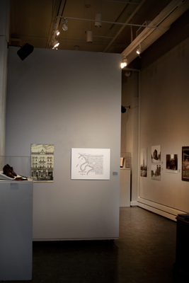
Amos Spafford in 1800 printed “A Copy of Spafford’s Map of Oct 1, 1796.” It shows the original street layout along with the initial 220 parcels. Nearby hills and marshes meant limited development especially in remote areas. Connecticut Land Company officials tried to rectify this situation by providing settlers in the outlying areas larger parcels at no additional cost. The letter A. refers to the Cuyahoga River; B. The Upper Landing, C. Public Square, D. The mouth of the Cuyahoga River and E. Lake Erie. This map does not include that part of Euclid Avenue running between Public Square and Playhouse Square. It was not surveyed until 1814. Detail of image in the center of the photo:
Exhibition Title
150 Years of Euclid Avenue's Greatness
Preview
Keywords
Euclid Avenue, Cleveland, Galleries at CSU